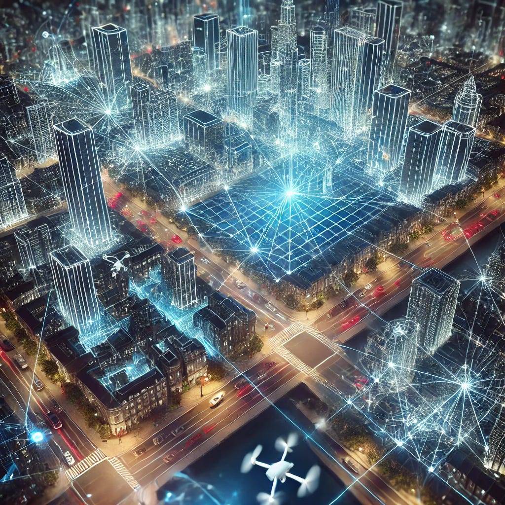
3D mapping has taken a leap forward with the combination of LiDAR and Gaussian Splatting, creating a new way to reconstruct large-scale outdoor scenes with stunning precision. Traditional methods struggle with the intricacies of outdoor environments, but LiDAR’s ability to capture depth paired with Gaussian Splatting’s approach to efficiently represent surfaces brings a game-changing approach. This is not just about mapping anymore; it’s about seeing the world through the eyes of robots, using data to build the most accurate picture of their surroundings. What makes this even more exciting is that this combination is able to process enormous amounts of data in real time, meaning it can be used in autonomous vehicles, drones, and countless future technologies that need to navigate complex terrains with laser accuracy.
Breaking Through Challenges in 3D Reconstruction
One of the hardest problems in 3D reconstruction is geometric accuracy in complex, unbounded outdoor environments. Until now, Gaussian splatting has struggled in these areas due to the ellipsoid shape of Gaussians, which don’t naturally align with thin surfaces, causing problems in surface fitting. But this new method breaks through by converting LiDAR point clouds into plane-constrained Gaussian Mixture Models (GMMs). This means it can now handle the outdoor world’s intricacies and sharp depth variations, eliminating the surface artifacts that used to plague previous models. With these advancements, the door opens to far more accurate mapping, from urban environments to forests, where every obstacle and detail matters.
Bringing the Invisible to Life
LiDAR is like a superhero of sensory data, shooting out millions of laser pulses that return to create a precise image of any scene. But it’s not just about collecting data; it’s about interpreting it. The fusion of LiDAR with Gaussian Splatting represents the next step in harnessing the power of light to shape digital landscapes. By feeding these precise measurements into the Gaussian framework, the algorithm ensures every surface, edge, and depth is accounted for. The 3D world it recreates is so rich in detail that robots can now navigate with confidence in ways they couldn’t before. And while that may seem like a tech detail, the real impact is on the future of autonomous systems that need this level of precision to make safe and intelligent decisions.
Expanding the Boundaries of Real-Time 3D Mapping
The future of real-time 3D mapping is not just about accuracy but also speed. This new method doesn’t just get the details right; it does it fast. Imagine a drone scanning an entire city in minutes or a self-driving car navigating the most challenging terrains without hesitation. By incorporating LiDAR at multiple stages — during initialization and optimization — this technology ensures continuous supervision over vast areas, mitigating the typical errors that plague large-scale reconstructions. Whether it’s improving the safety of autonomous vehicles or helping robots navigate unfamiliar terrains, the impact of this innovation stretches across industries. The best part? It’s only just beginning.
LiDAR Lasers Bounce Millions of Times Per Second
LiDAR works by sending out laser pulses — millions of them — that hit surfaces and bounce back to measure distance. These lasers can hit almost any object and return in microseconds, allowing the system to build an extremely detailed 3D model of any environment in a flash. It’s like having superhuman vision that extends across vast landscapes.
Gaussians Help Computers See Depths
Gaussian splatting, despite sounding complicated, is what allows computers to take those millions of LiDAR measurements and transform them into surfaces that we can see. The neat part? Gaussians are mathematically modeled like ellipsoids, which helps the computer understand where each surface should be, how thick it is, and what it’s made of.
Self-Driving Cars Use This Tech to Stay Safe
Autonomous vehicles rely on LiDAR and Gaussian splatting to see the road, understand obstacles, and navigate tricky environments. Without these technologies working together, self-driving cars would have a much harder time identifying the complex details of the world around them in real time.
3D Mapping Is Now 52.6% More Accurate
Compared to traditional methods, using LiDAR with Gaussian splatting improves geometric accuracy by over 50%. This leap forward means that 3D maps are more reliable and precise than ever, which makes a huge difference when it comes to robots understanding and moving through the world safely.
The graph below highlights how the LI-GS system outperforms both traditional LiDAR and Gaussian-based methods in reconstructing complex, large-scale environments with unprecedented precision.
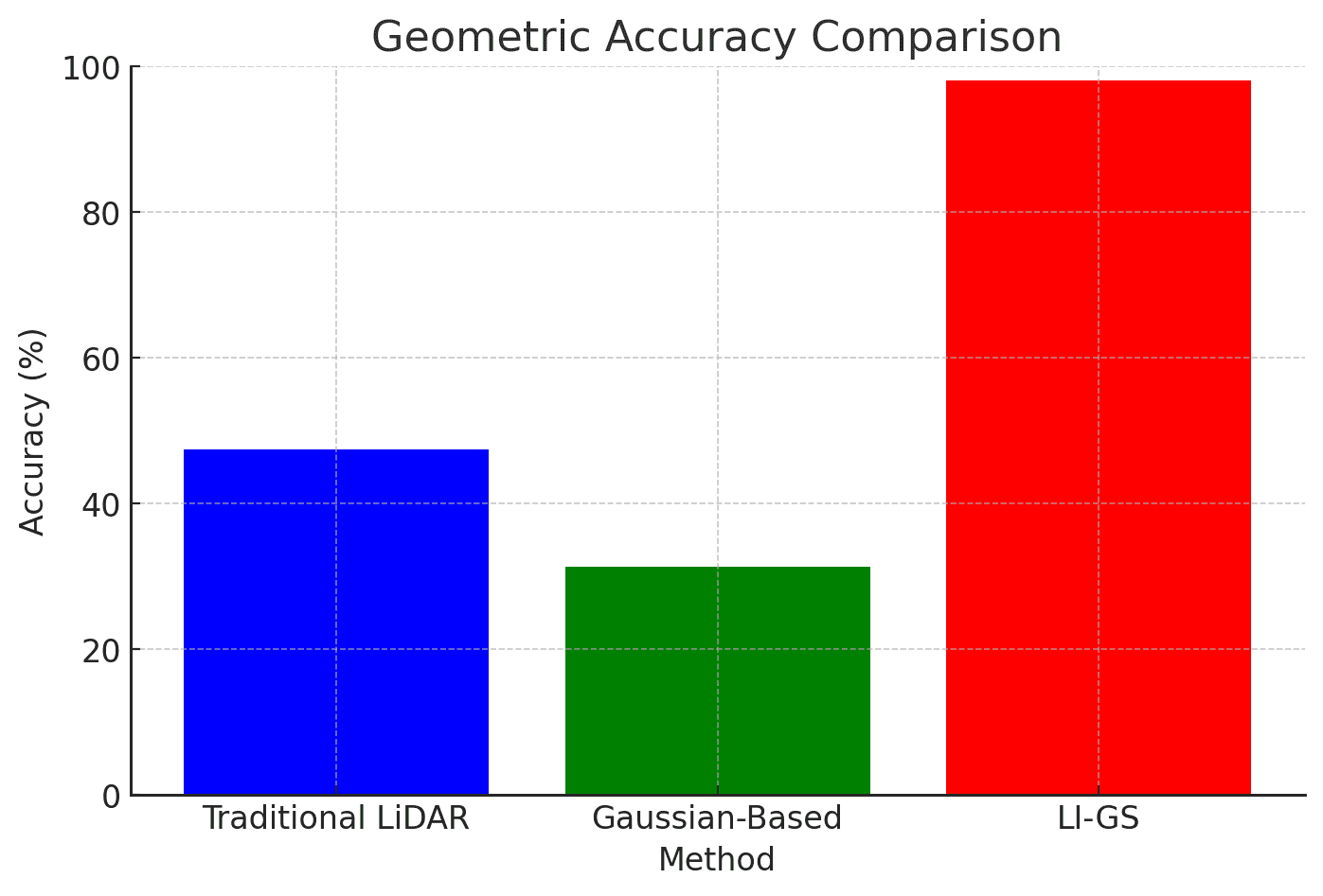
This clear improvement in accuracy, as depicted, demonstrates the massive leap forward that LI-GS offers, making it a vital technology for future applications.
This Tech Is Helping Build Future Cities
Imagine an entire city being mapped digitally in hours instead of weeks. This tech is being used to recreate massive outdoor environments with incredible detail. Urban planners, architects, and developers can now visualize projects in real time, creating smarter cities that grow and evolve faster than ever.
Shaping the World of Tomorrow with LiDAR and Gaussian Splatting
The fusion of LiDAR with Gaussian splatting isn’t just a technical advancement; it represents a powerful step toward how future systems will perceive and interact with their environments. Whether it’s autonomous drones, self-driving cars, or even robots that assist in emergency rescues, this technology is the backbone that will allow them to “see” in ways we could never have imagined. It’s shaping the future — one laser pulse at a time — and it’s only a matter of time before it becomes the norm in every cutting-edge system. With the potential to revolutionize how we map, explore, and interact with the physical world, LiDAR and Gaussian Splatting are ready to make the impossible, possible.
About Disruptive Concepts
Welcome to @Disruptive Concepts — your crystal ball into the future of technology. 🚀 Subscribe for new insight videos every Saturday!
See us on https://twitter.com/DisruptConcept
Read us on https://medium.com/@disruptiveconcepts
Enjoy us at https://www.disruptive-concepts.com
Whitepapers for you at: https://disruptiveconcepts.gumroad.com/l/emjml

